Games have always been a great tool for teachers to engage students and make learning fun. For example, they have been used effectively to help students understand such diverse topics as historical events and environmental issues. I fondly remember learning about Westward expansion through the online game Oregon Trail as a sixth grader. This early computer game allowed students like me to lead a caravan of settlers West across Missouri to Oregon. Along the way, I encountered hardships and decision points that mirrored those of early settlers that I still remember today.
Thanks to improved technology and expanded Internet access over the past twenty years, the process of using games to facilitate problem solving or learning – known as gamification – has accelerated both in terms of complexity and enjoyment. Last year, at the National Day of Civic Hacking in Burlington, a new game called Lakecraft, based on the popular game Minecraft, was created to teach students about the Lake Champlain Watershed.
I’ve asked Lakecraft founders, Nina Ridhibhinyo, Group Programs Manager at ECHO Lake Aquarium and Science Center, and Nicholas Floersch, GIS/Web Applications Specialist at Stone Environmental, to explain how the game came about, how teachers can use it, and how Lakecraft might also include other Vermont watersheds.
The Vermont Digital Economy Project will be facilitating a conversation between the Lakecraft developers – technical and curriculum – on May 19. The workshop will focus on how we can expand Lakecraft to other watersheds in the state.
Lakecraft is a virtual world modeled in the computer game Minecraft, using open Geographic Information System (GIS) data on the Lake Champlain watershed. The idea for Lakecraft was inspired by a 2013 Freshwater Summit held at the ECHO Lake Aquarium and Science Center, at which Vermont Agency of Natural Resources Commissioner David Mears casually fantasized that someday his child would play a hypothetical, educational game he dubbed “Lakecraft” rather than spending all his time on Minecraft. After exploring avenues for “gamifying” big data as part of the work of the Summit, ECHO was struck by the novelty of Mears’ remark. Lakecraft appeared an attractive solution for two reasons: (1) It could capitalize on an existing platform, adapting an already popular game for educational use, and (2) it was “hackable” by design, encouraging users of all levels to modify worlds in game play and through computer programming.
By creating a digital elevation model of a watershed in its entirety and layering openly available GIS data, Lakecraft immerses its users in a rich 3-D environment based on natural boundaries and real geographic data, enriching understanding of the scale and function of a watershed through virtual, first-hand experience.
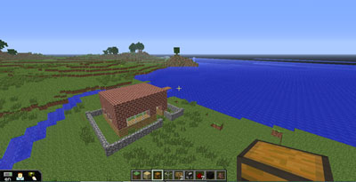
For those who are not familiar, Minecraft is a popular, multiplayer sandbox game that models imaginary worlds in a virtual environment. Within Minecraft, players are able to craft everyday items (shovels, houses, bricks, boats, etc.) using blocks within the game’s environment. Minecraft’s functionality lends itself to the teaching of various subjects, including ecology, chemistry, and physics. Employed correctly, it can be used as a powerful tool for engaging students in the exploration of real world spatial data and introductory programming.
ECHO began testing early versions of Lakecraft during our 2013 summer camps for elementary-aged children. During camp, the children explored the virtual Burlington Waterfront, making observations and then brainstorming structures they could build to support the waterfront environment. One group built a model of the Ethan Allen. Others built a breakwater, a lighthouse, docks, and railroad tracks. As a group, they also marked out future building sites with signs, such as “Future ECHO.” The kids were also eager to make virtual “play dates” after camp to continue their work.
The Lakecraft team has applied for a US Ignite grant to cover the cost of providing Lakecraft on the new Burlington Civic Cloud. This will be an important step in facilitating others in the community to use and further develop Lakecraft or similar virtual watershed models.
* * *
Interested in learning how teachers can use Lakecraft in their classroom? Below are a few suggestions. We highly recommend that classroom educators purchase the MinecraftEdu package rather than conventional Minecraft game licenses, because it provides more control features important for teachers. Visit minecraftedu.com for more info.
High School/College:
Students can explore available GIS data sets, such as population data, environmental data, and transportation data, for our region and then port them into the Lakecraft world. Enacted in different grade levels simultaneously, younger students could explore what data is available, possible ways to look at it, and what value it could bring to their world. Older students could use priorities set by younger students as to which data should be brought into the game to guide their own work in bringing the selected data through the series of GIS manipulations necessary to integrate it into the game.
Middle School/High School:
Minecraft as a platform is easy to extend in many ways through programming. Because Lakecraft combines a game many students are already familiar with and representation of the world the students actually live in, the Lakecraft platform can become an easy bridge for computer programming educators to invite students across. Programming projects related to Lakecraft can be very simple in-game explorations of Boolean logic requiring no programming at all, basic programmatic scripting, and simple through advanced levels of game, graphic, and network programming. GIS and spatial systems can be integrated into the programming curriculum as an option.
Middle School:
Students can locate and research significant geographic sites in the Lake Champlain Basin, such as Camel’s Hump, Juniper Island, and Bulwagga Bay, and then interpret them by constructing signage and placing informational books at those locations. For those interested in bringing the time spent in-game back to the real world, students could work together in-game to plan a real-world hiking trip or tour. Educators could prepare more cross-overs such as first visiting UVM’s whale bone display with the class, and then in-game having students find and dig-up representative items buried (by the instructor) where the whales were actually found. Similarly, a string of geo-cached clues, both in the real world, and in the game world, could lead students on a tour of whatever topic the instructor might want to teach about.
Elementary School:
Students can identify important community resources, such as energy suppliers, food system providers, and transportation networks, and then build a model community in Lakecraft. The community built could be more physical in nature such as “this is what a town looks like so let’s build some buildings with respect to nearby resources” or the community could be focused on exploring how different jobs in the community are dependent on each other such as farmers, builders, guardians (police, firemen), and explorers. The group could also think about simple ‘laws’ and how to handle misbehavior.